History of the Site

The south Alouette River Watershed is a relatively small system (144 sq. km). The river flows 21 km from the Alouette Reservoir to the Pitt River. The dam placed at the south end of a natural lake and river system obstructed all anadromous fish stocks and significantly decreased the amount of habitat available to local fish populations in the river downstream of this new dam. Salmonid species that had previously spawned upstream of the dam and required a lake as part of their life-cycle were completely blocked from this upstream access and as a result sockeye, and gradually over time, chinook salmon were extirpated from the system.

Some off-channel habitats have been permanently lost or seasonally reduced due to the decreased river flow and the altered hydrograph. The south Alouette River is said to have lost almost 4.5 km of accessible mainstem and tributary habitat (BCRP, 2000). In addition, the quality of the habitat has been impacted by the lack of instream materials, such as wood and gravel, being transported downstream from the upper reaches of the watershed. Juvenile coho salmon and steelhead critically depend on these overwintering pond and channel complexes to prepare for their spring migration to estuary and marine waters. Adult and juvenile cutthroat rely on food sources but also depend on these slower moving side channels as protection from winter storms and spring freshets. Other wildlife rely on these riparian areas of side channels including painted turtles, frogs, beavers, otters and minks who also reside along the quieter sections of the ponds.

Figure 1. Location of new Coniagas Channel between Steward Pond 1 and 2

Goals and Objectives

The Alouette Watershed strategic plan identified loss and changes in former rearing and overwintering areas as well as riverine and riparian habitat as key limiting factors impacting fish and wildlife diversity and production. To this end, the Coniagas Spawning and Rearing Channel Project addresses the following strategic objectives:

  1. Conserve and improve fish habitats in the lower Alouette River as a means of improving fish stocks.
  2. Enhance wetland and riparian habitat for aquatic species.
  3. Encourage private landowners to invest, develop and improve aquatic habitat on their property.
  4. Complete small scale complexing with large woody debris (LWD) to reduce predation of fish, improve natural morphological contouring and enhance invertebrate populations (Clayton/Zaldokas, 1999)
  5. Control erosion and moderate water temperature by planting native vegetation in the riparian zone

Having identified the need for habitat enhancement, work started on the 17th September at the Coniagas Ranches, located on property along the Alouette River in Maple Ridge to create additional overwintering habitat for salmonid species. Our long term objective is to increase the salmon smolt production within the Alouette River system by creating these additional environments, such as spawning and rearing channels and ponds. The project objectives were to produce 1000m2 of off-channel habitat for various salmon and trout species and to create 800m2 of riparian habitat including planting native species of berry-producing and wildlife-friendly shrubs and trees.

Figure 2. A natural swale in the floodplain, site of new Coniagas Channel seen before construction, October 2011
Figure 3. Intake and outake views of the potential channel project before construction, October 2011

Methods of Project

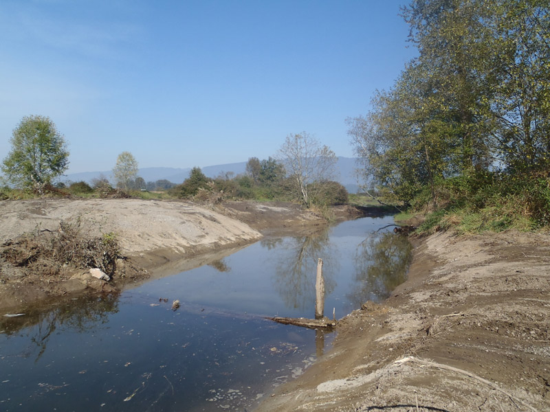
The habitat project involved the excavation and complexing of approximately 1000m2 of offchannel habitat following a natural swale (Figure 2) that typically floods during high flows and the replanting the new riparian habitat with native species. A channel was constructed within the project area of Stewart Ponds 1 and 2 using Pond 1 as the intake for the new channel and Pond 2 as the outtake (Figure 3). At the upstream section of the site, the project team excavated a low lying reed canary grass area, creating a pond-channel complex which joined with the south Alouette River through one side channel. At the mid-point and to the east of the new channel, the project team created a new pond (Jenny’s Pond) with approximately 100m2 of large woody debris and bouldering.

Coniagas Seed Planting
Figure 4. Grass seeding of disturbed area, September 2012
Figure 5. Excavation of new pond and channel at Coniagas Ranches, September 2012
 Figure 6. Placement of constructed LWD pods, September 2012

ARMS projected that we would produce 1000m2 of new off-channel habitat, however, we were able to produce a total of 2199m2 of combined rearing and riparian habitat – 802m2 of off-channel area and 1397m2 of riparian area. In addition, ARMS and DFO were able to produce pond habitat (Jenny’s Pond) which was constructed along with the off-channel refugia. Approximately 800 native trees, shrubs, marsh and aquatic plants were installed along the site area to create 1397m2 of riparian habitat.

ARMS was in charge of the site and administration project management, working in conjunction with DFO, Katzie First Nations, Mission Contractors, and Unicorn Trucking.

Coniagas Channel Construction
Figure 7. Native shrubs, trees, and marsh plantings installed on site, November 2012
Coniagas Channel Construction

The Coniagas Spawning and Rearing Channel was a joint partnership between the Alouette River Management Society (ARMS), Department of Fisheries and Oceans Canada (DFO), and a private land owner in Maple Ridge, BC, with the financial support of BC Hydro’s Fish and Wildlife Compensation Program.

This project was generously funded by the BC Hydro’s Fish and Wildlife Compensation Program.